
Antartica Again!
by John
Large sections of Antarctica have been suddenly hidden from view on Google Earth Pro, using fake clouds and checkerplate patterns.
They ARE fake because 1. they appeared suddenly (just a day after I had posted photos of strange objects, with coordinates, and the “clouds” neatly covered the areas about which I had posted. 2. the “clouds” are present, despite turning off atmosphere in GEP. 3. the “clouds” are present in all dates of the timeline, extending back 20-30 years, and the cloud pattern is unchanging over those decades.
Well, the fake clouds are still there, obscuring the interesting area, so I spent some time looking at a nearby area beyond the clouded area.
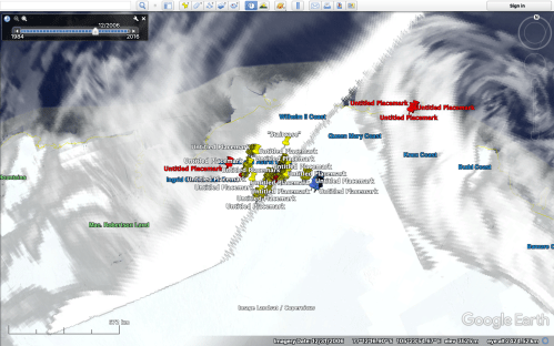
The red and yellow placemarks are those which the “clouds” and the “checkerplate” neatly cover. The blue placemarks are those placed by me today. They are not obscured, yet. Take a look at what they are showing in the following photos.

Zooming in a bit, still 665km above the surface, showing the position of the blue placemarks. The checkerplate line zigzags across the screen and everything to the left is deliberately (IMO) obscured. Scale is bottom left, and compass top right.

Look at that straight line of odd objects. I counted 28 of them, at about 1 km intervals. From 14km above the surface. Maginot Line?

Zooming in closer. Same again! 300m long, 200m wide, black centre, grey objects surrounding. Still 2006. They appeared in 2004 and disappear 2008. 2006 is the clearest year. From 5km above surface.

And another. Dozens of them in this area. These are NOT natural features.
And the huge black rectangular object which is still showing in Google Maps…
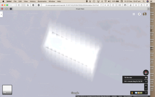
A Google Maps image said to be taken in 2018.
Open your eyes people. There is stuff going on, and we are not being told.

John
I assume the tecs at Google earth know or are instructed to “cloud” these areas unless they are simply a passive conduit
Can they be asked to clarify ( no pun intended) their role Tim
LikeLike
Waste of time Tim.
LikeLike
It is all so intriguing! Like you, I want answers.
There are so many satellites scanning the earth – many in polar orbits – that it is hard to imagine that better images aren’t available.Probably have to pay for them.
.
LikeLike